|
Chennai, or Madras, is the capital city of the Indian state of Tamil Nadu. Located on the Coromandel Coast off the Bay of Bengal, it is a major commercial, cultural, and educational centre in South India, while the port of Chennaiis the second largest port in India. As of the 2011 census, the city had 4.68 million residents making it the sixth most populous city in India; the urban agglomeration, which comprises the city and its suburbs, was home to approximately 8.9 million, making it the fourth most populous metropolitan area in the country. Although the area has been part of successive South Indian kingdoms through centuries, the recorded history of the city began in the colonial times, specifically with the arrival of British East India Company and the establishment in 1644 of Fort St George, an English settlement. The British defended several attacks from the French colonial forces, and from the kingdom of Mysore, on Chennai's way to become a major naval port and presidency city by late eighteenth century. Following the independence of India, Chennai became the capital of Tamil Nadu and a hotbed of regional politics that tended to bank on Dravidian identity of the populace. Chennai had become a bustling metropolis with beautiful classical and colonial European styled buildings, lining the city’s thoroughfares. The region around Chennai served as an important administrative, military, and economic centre since century. During 1st century CE, a poet and weaver named Thiruvalluvar lived in the town of Mylapore (A neighbourhood of present Chennai). From 1st century CE until 12th CE the region of present Tamil Nadu and parts of south India was ruled by the Cholas. Stone age implements have been found near Pallavaram in Chennai. According to the Archaeological Survey of India (ASI), Pallavaram was a megalithic cultural establishment, and pre-historic communities resided in the settlement. The Pallavas of Kanchi built the areas of Mahabalipuram and Pallavaram during the reign of Mahendravarman I. They also defeated several kingdoms including the Cheras, Cholas and Pandyas who ruled over the area before their arrival. Sculpted caves and paintings have been identified from that period. Ancient coins dating to around 500 BC have also been unearthed from the city and its surrounding areas. A portion of these findings belonged to the Vijayanagara Empire, which ruled the region during the medieval period Reference:
0 Comments
Mianwali is the capital city of Mianwali District and situated in the north-west of Punjab province, Pakistan. The city is located on the eastern bank of the Indus River. Thal canal traverses the city and makes the surroundings a picturesque place. According to the 1998 census of Pakistan, the Mianwali city had a population of 85,000 inhabitants. In November 1901, present day towns of Mianwali, Bhakkar, Isa Khel, Kalabagh, and Kundian were separated from Bannu District and hence a new district named as Mianwali District was created with the headquarters in Mianwali city. The municipal committee was founded in December 1903 and has remained operational since then. Before the British rule, the area formed an integral portion of the Graeco–Bactrian Empire of Kabul and the Punjab. During British rule, the Indian empire was subdivided into provinces, divisions and districts; afterward, the independence of Pakistan divisions remained the third tier of government until 2000. The British had made the town of Mianwali as tehsil headquarters of Bannu District then part of Dera Ismail Khan Division of Punjab province. The population of Mianwali, according to the 1901 census of India, was 3,591. In November 1901, the North-West Frontier Province was carved out of Punjab and the towns of Mianwali, Isa Khel, Kalabagh, and Kundian were separated from Bannu District (Bannu became part of NWFP) and hence a new district was made with the headquarters in Mianwali city and placed in Punjab. The district became a part of Multan Division. There were four tehsils namely Mianwali, Isa Khel, Bhakkar, and Layyah. Layyah was included in the Muzaffargarh District in 1909. The district became a part of Sargodha Division in 1961. Bhakkar Tehsil was carved out of Mianwali District and was made a separate district inside Sargodha Division w.e.f. 01-07-1982. Sawans is the One of famous UC of this district. Reference: The Dodiya are a Rajput clan found in the states of Gujarat and Rajasthan in India.
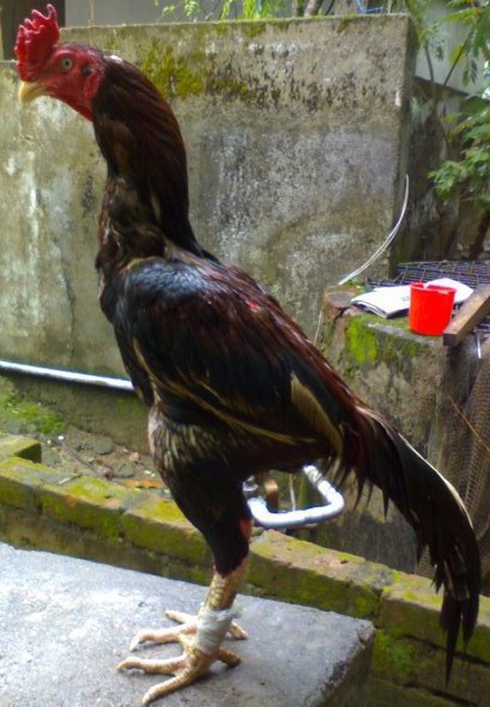
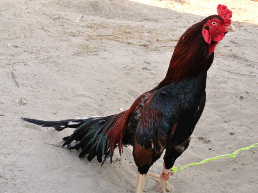
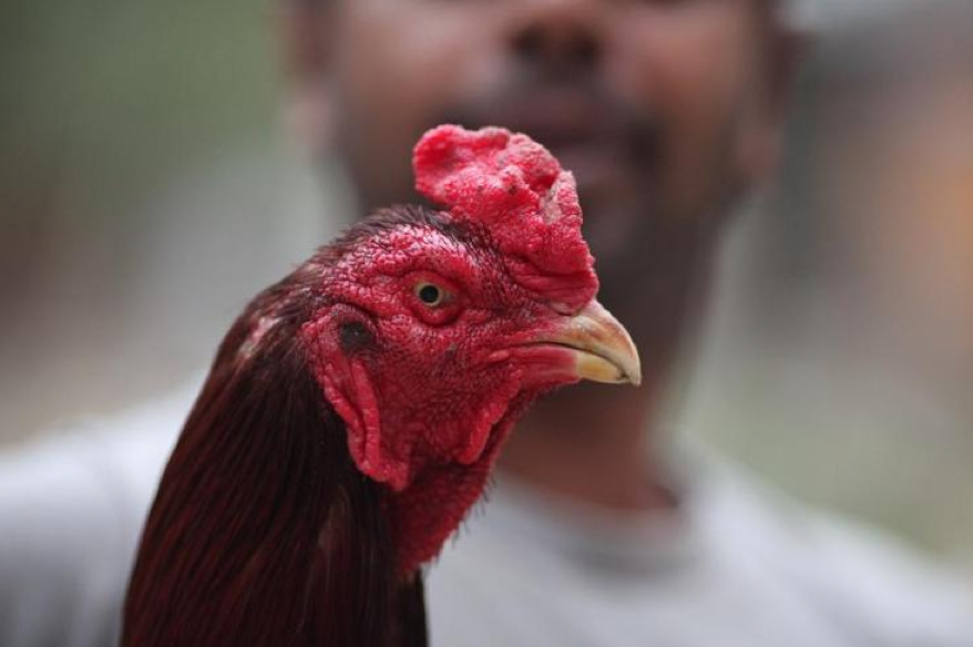
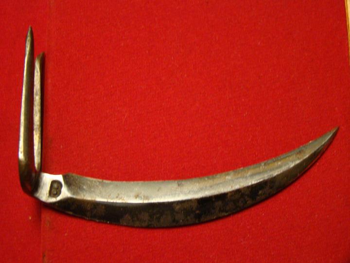
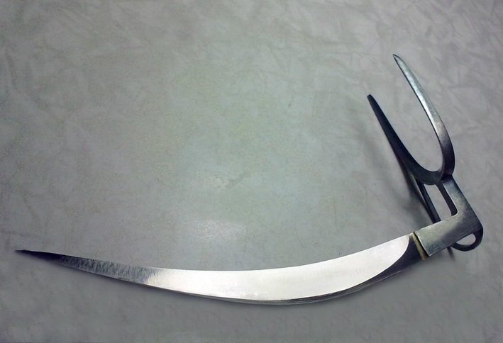
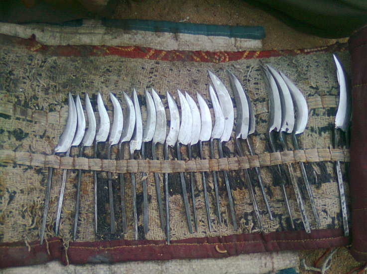
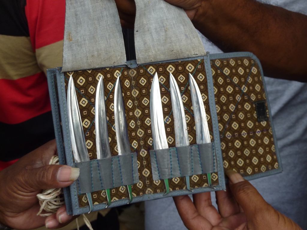
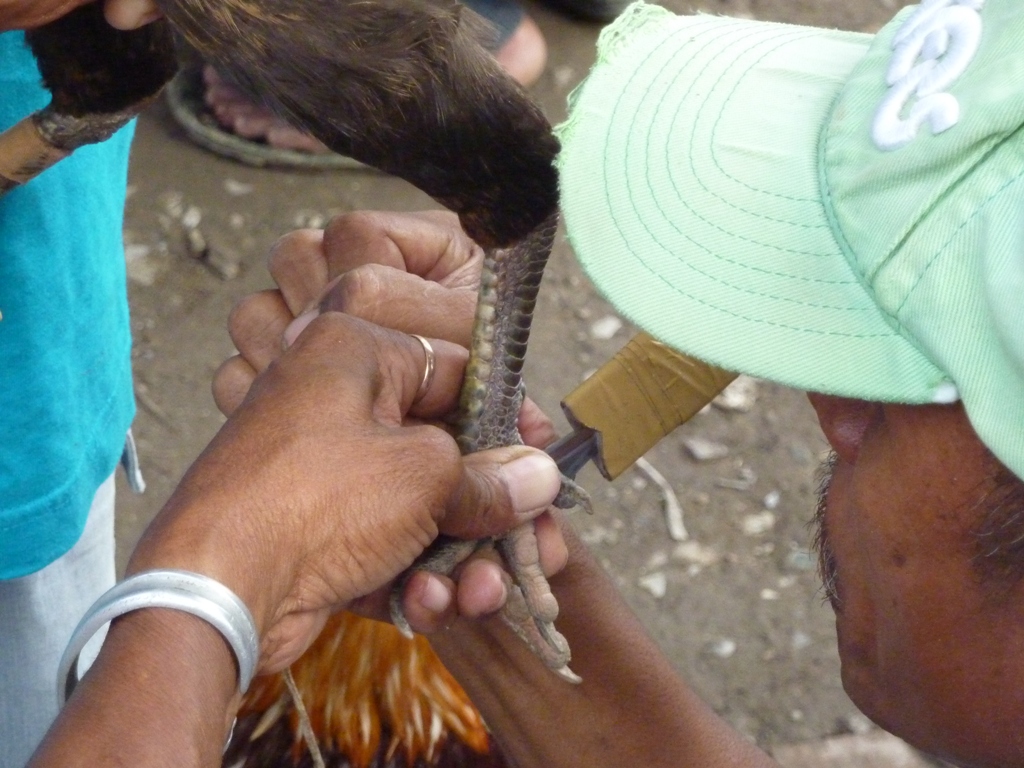
The Dodiya are Chandravanshi Rajputs, and according to their traditions, they were based in and around Multan in Punjab (now in Pakistan) during 12th and 13th centuries, when they built a fort near Multan by the name of Rohtashgarh. In the 14th century the Dodiya Rajputs migrated to Gujarat and established their kingdom around Girnar (Junagadh)). The first rajah of this state was Phul Singh Dodiya, followed by Rawat Soorsinghji, Rawat Chandrabhansinghji, Rawat Krishnaji, Rawat Chalotji and Rawat Arjundasji. A small number of the Dodiya migrated to Mewar accompanying the Rajmata of Mewar as an escort. The Dodiyas proved their valour in various battles in the service of Mewar, including the Battle of Haldighati, and were rewarded with the jagir of Lava (later called Sardargarh). The remainder of the Dodiya remain in Gujarat. Once, on a pilgrimage to Gujarat, the mother of Maharana LAKHA (1382-1421) of Mewar and her party were attacked by dacoits (bandits). Siha Dodiya came to the aid of the party. Unfortunately, Siha the Good Samaritan was killed in the skirmish, but two of his sons, Kalu and Dhaval, took the royal travellers to safety in the Dodiya residence, then escorted them back to the Mewar border. Maharana Lakha later invited the two sons of Siha Dodiya to Mewar, and gave them the jagir of Laava (later called Sardargarh), with the status of 1st Rank Umrao's (Nobles) of Mewar. They also had a house in Udaipur, the DODIYA-KI-HAVELI, where the family stayed whenever they were in the capital. The descendants of Sardargarh are of Dhaval Dodiya. Reference: Amroha is a town in north-western Uttar Pradesh state in northern India, located north-west of Moradabad, near the Sot River. It is the administrative headquarters of the Jyotiba Phule Nagar district The name of Amroha may derive from its production of mangoes (aam) and fish (rohu). Another possibility is that Raja Amarjoda, of the Bansi dynasty, named the region Amroha in 474 BC. The author of Tarikh-i-Amroha states that Amroha was ruled by Rajputs between 676 and 1141 AD. Mahmud of Ghazni conquered Amroha in 589 AH/1093 AD. Behram Shah (1240–42) appointed Malik Jalaluddin to the position of Hakim of Amroha in 1242. Ghiyasuddin Balban crushed a rebellion in this region, and so ruthless was his repression that the territory of Badaun and Amroha remained quiescent till the reign of Jalaluddin Khalji. Ambar Sultani built a mosque at Amroha. During Alauddin Khalji's reign, Malik Tughluq and Malik marched to confront the Mongols through Amroha. Saiyid Salim was assigned Amroha and Sirsi as an iqta and after his death, the iqta was assigned to his sons. It is also recorded that Khizr Khan was punished by Alauddin Khalji with an enforced stay at Amroha with Hisamuddin. The historical architecture of Amroha begins with the fort wall, remnants of which still stand. The Moradabadi Darwaza, built by Saiyid Abdul Maajid in 1642 AD, is the only extant gate. The wall was constructed during the reign of Shah Jahan, by Siyadat Maab Saiyid Abdul Maajid, who had constructed this fort under the supervision of Kamal Khan Khanazad in 1652 AD. It is fifty feet high with three parallel arches, covered with a roof. Other monuments from this period include mosques, idgahs, khanqash, dargahs, imambaras, diwan khana, madrasas and mandirs. Some of these are of the Delhi Sultanate period, others of the Mughal period. The Sadaat Amroha or Amrohi Syed are a community of Sayyids, historically settled in the town of Amroha, in Uttar Pradesh, India. Many members of Sadaat Amroha community have migrated to Pakistan after independence have settled in Karachi, Sindh. The town of Amroha has been home to one of the oldest Naqvi Sadat settlements in India. Naqvis in Amroha arrived from Wasit, Iraq and have been resident in the town of Amroha since the 1190s A.D. The Sadaat Amroha belong mainly to the Naqvi sub-group, mainly due to the fact, that they are all decedents of the famous Sufi saint Hazrat Syed Sharfuddin Shah Wilayat (a true 9th direct decedent of Imam Ali Al-Naqi), who was highly respected religious figure in Wasit, Iraq and later in India during the early ages of Islam in the Indian subcontinent and the khalifa of Hazrat Imam Suhrawardi R. The majority of Amrohvie Sadaat are Naqvi, predominately of Shia and Sunni sects. According to the 1901 Census of India, the main sub-division of the Sayyid was the Husseini and Naqvi. Sayyid is an honorific title, it denotes males accepted as descendants of the Islamic prophet Muhammad through his grandsons, Hasan ibn Ali and Husain ibn Ali, sons of the prophet's daughter Fatima Zahra and his son-in-law Ali ibn Abi Talib. Daughters of sayyids are given the titles Sayyida, Alawiyah, Syarifah, or Sharifah. Children of a Sayyida mother but a non-Sayyid father cannot be attributed the title of Sayyid, however they may claim the title Mirza for males or Mirziya for females. Sayyids are by definition a branch of the tribe of Banu Hashim, a clan from the tribe of Quraish that traces its lineage to Adnan and thence to the Prophet Ismael. In the Arab world, it is the equivalent of the English word "liege-lord" or "master" when referring to a descendant of Muhammad, as in Sayyid John Smith. This is the reason the word sidi (from the contracted form sayyidī, 'my liege') is used in the Moroccan dialect of Arabic. Reference: Rampur is a city and a municipality in and headquarters of Rampur District in the Indian state of Uttar Pradesh. It is known for its various industries, including sugar refining and cotton milling. Its library has more than 12,000 rare manuscripts and a fine collection of Mughal miniature paintings. Faizullah Khan (c.1730 - 24 July 1793) was the first Nawab of Rampur. The princely state of Rampur was set up in 1774, after the First Rohilla War, by the dismemberment of the Rohilla state of Rohilkhand. Faizullah Khan, the surviving heir of Ali Mohammed Khan and opponent of the forces of Awadh and the British East India Company in the war, was installed as ruler of what was a puppet state. It bordered the Maratha Empire to the south, making it a strategic point. Under tutelage of the East India Company, Faizullah Khan ruled peacefully for 20 years. The capital Rampur was founded, and the Raza Library collection gathered. Reference: Peruvian Long Knife or Peruvian Slasher is a cockfighting weapon tied on the left shank using a boot. It is only 3 inches in length, even if Peruvian Knife Gamecock Roosters are large and weighs more or less 5 kilograms. (American Gamecock Roosters are about 2.5 kilograms. Nowadays in the Philippines, the Long Knives are 4-5 inches tied to American Gamecock Roosters) Filipino Long Knife is a cockfighting weapon tied on the left shank. The length vary a lot from 2.5 inches to more than 5 inches. Nowadays, 4 inches and longer is more popular than 3 inches and shorter. Hence, the knife is longer than the shank of the rooster. Indian Long Knife is a cockfighting weapon tied on the right shank. Or right foot fingers. Typically, it is a double edge knife. Knife cockfighting in India is more popular in Southern India. And the Indonesian Islands of Java and Bali are nearby. Thus, Indian Long Knife is similar to Balinese Taji, except the Indian Long Knife have a longer handle than Balinese Taji. East Timorese Long Knife is similar to Indonesian Taji and is also tied on the left shank.
East Timor is a sovereign country. West Timor is part of Indonesia. Thus, East Timorese Long Knife is similar to Indonesian Taji particularly the Balinese Taji, except East Timorese Long Knife have shorter handle than Balinese Taji. |
Categories
All
Archives
January 2013
|



 RSS Feed
